If you have not come to this page from the sequence starting at Starting a New Cave" then go and read that first.
After typing in all the data in survex format , run aven (the GUI interface - installed when you installed survex) and print out a centre-line plan.
OK if this is your first time doing this, you need to go through the "How to use survex" training procedure.
Seriously, go and follow all the rest of the links you skipped the first time in the "How to use survex" training procedure.
Use aven to print out the centre lines of the passages. Now you will have to decide whether to use Tunnel or Therion. Expo has a polciy decision on this: if it is an entirely new disconnected cave, then use Therion. If it is a passage in a cave where previously we used Tunnel, then use Tunnel. See also Comparison of Tunnel to Other Cave Software.
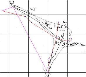
Now scan your sketch, transfer the file to the expo laptop and open it in Tunnel (or Therion). Using a mouse on the screen within Tunnel (or Therion), you will then trace over the image and thus create a vector drawing of the cave. Very detailed instructions for doing this in Tunnel are in Tunnel Wiki: Raw Sketch Data
The files of your scanned and re-scanned sketches should be stored in the same folder as the scanned notes, i.e. (for wallet #19, for expo 2018) you would upload them to folder 2018#19. This is actually stored in: /home/expo/expofiles/surveyscans/2018/2018#19/ but you don't need to know that as the Upload Scan form just uses the wallet name 2018#19 (but this is not where you will put your finished Tunnel or Therion vector files.)
Tunnel only produces plan surveys, but they are very pretty.
The tunnel (or therion) vector files should NOT stored in the same folder as the scanned notes. You will upload them to the version-controlled repository drawings using the Upload Drawings form. You will put them in the Uploads Folder. You can create your new subfolders there by typing them in to the browser address bar, e.g. my new subfolder
If you are working on the expo laptop then put them in /home/expo/drawings/{cavenumber}. Look at what is in there already and ask someone which directory to put them in. It will probably be a folder like this: /home/expo/drawings/264-and-258/toimport/
You may find Christian's therion templates helpful.
Make sure the drawing clearly shows the point of connection to previous surveys (look at the relevant drawing in the old survey book to ensure the sketches match and you really have connected where you think). Make sure you note which Question Mark was addressed by this survey and show the location of any new question marks, with an estimate of quality and any difficulties which will be encountered (eg. if it is a climb, are bolts going to be needed ? If a dig, is it a few loose boulders or a crawl over mud?)
The actual published cave-survey is produced by software these days. These notes come from a different age but reading them will make your tunneling better and more polished:
Drawing a cave entirely by hand is not easy but anyone can learn to do it. Read the brief Cave Mapping - Sketching the Detail" 5-page llustrated guide by Ken Grimes which makes everything clear. For preliminary exploration (Grade 1 surveys) this is still appropriate.
CUCC use a set of symbols pretty close to the standard ones promulgated by the BCRA, with occasional differences - such as large-enough boulders which are sketched to scale using the US symbol. The current state of standardisation for cave survey symbols (a useful guide to what we should be using where possible) has been documented by Häuselmann, Weidmann and Ruder (1996), but this is up for discussion in 1997. An alternative set of standards can be seen from the Australian Speleological Federation here.
Make sure that you draw both plan and elevation (the latter should be an extended section, rather than a projected elevation) for horizontal passage. For pitches, several plans at different levels may be easiest (rather like the cross sections at each survey station used in horizontal passage). Also projected elevations may be useful in addition to the extended section. But learning a good set of procedures for using survex is the way to go.
If you did all that properly, there should be very little left to do in the UK, unless you have volunteered to help with drawing up the final survey. (Fool!) However, it is as well to check that you have done all you can before BCRA conference, by reading the Back in the UK page.
Back to the previous page in this sequence Starting a new survex file.
Now go the the next page in this sequence Creating a new rigging guide".